30 and 90 Day Forecast
30
Day
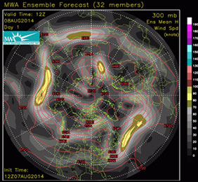
Ensemble Maps
May 19 - Long Range Summary
Unseasonably cold air overwhelming the Great Lakes and Northeast late this past weekend (11°-15° below average) is near certain to represent the start of two solid weeks of below average temperatures. In addition to increased duration of cold air reinforcement deep into the Eastern U.S. successive model runs have yet to plateau progressively colder forecasts. Latest forecasts valid midweek (May 21-22) are more than 20° below average which translates to high temperatures struggling to reach 50° across the Great Lakes and Northeast, with frigid overnight lows by late spring standards (30s) which may lead to high elevation snow. The resultant airmass clash with summer-like heat lingering across the southeast quadrant of the U.S. (hottest from Texas along the Gulf Coast to Florida) is a recipe for additional widespread rain and severe thunderstorms (including tornados) through the next few days. However, once cold air ultimately floods the Southeast at the end of this workweek (10° below average or more) several days devoid of impactful severe weather will ensue across East. However, that may not be the case in most of Texas as models follow the next significant warming trend (90s-100s) set to begin late this week (May 23-24) with wetter conditions early next week (May 26-27). Beneficial rain in central or southern Texas and associated rain cooled temperatures during the final week of May appear overdone as models struggle with ultimate strength and duration of an unseasonably hot Western ridge already building along the West Coast. Regardless of details in how spring ends the West and Plains remain forecast to represent the core of hottest early summer temperatures, while slowly moderating below average temperatures linger between the Ohio Valley and Northeast into the start of June. Longer range 30-day MWA ensemble forecasts begin to periodically expand central U.S. heat to the East Coast near the end of the 1st week of June, but in a less intense or prolonged form interrupted by seasonal level temperatures into late month adding confidence to a milder 1st month of summer in the East than observed in 2024.
If your business or career depends on correctly predicting the weather, you can follow the pack or you can get ahead with MWA’s proprietary models and expert forecasts.
Model Data
Custom Tools
Consulting
Our Proprietary Forecast
For more than a decade, the most accurate weather forecasts over any time scale have come from only one source Melita Weather Associates
We owe our success to three factors:
- Our World Class Meteorologists and Climate Scientists
- The Industry’s Only Operational Climate Based Weather Model
- Specialization in Weather Products for Markets and Traders
Our Customers
Melita’s forecasts are written for professional traders and business people in Weather Impacted Business.
- Energy Traders
- Commodities Markets
- Large Scale Producers
- Governments
- Electric Utilities
- Hospitality & Recreation
Melita’s information packed forecasts assume a knowledge of weather patterns and their implications.30 and 90 day forecasts are written to deliver vital information while saving time for busy professionals.At the same time MWA forecasts have considerable detail and are backed up by our personal consultation services.