30 and 90 Day Forecast
30
Day
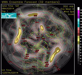
Ensemble Maps
November 17 - Long Range Summary
Another lobe of Canadian air diving into the Northeast late this past weekend is of high confidence to represent the final brief interval of unseasonably cold temperatures and widespread Eastern snow in November. Today is near certain to represent the coldest day of the next 2-weeks across the Northeast (highs mainly 30s) and northern mid Atlantic region (highs manly 40s), after which unseasonable warmth currently entrenched in the southern Plains (80s-90s between Texas and Oklahoma) expands across the entire Midwest and East in a less intense but sustained manner reversing Northeastern temperatures above average (50s) by the end of of this workweek (Nov 21). At the same time increased precipitation frequency and coverage starting across the Midwest, South, and East (nearly all rain) will limit milder temperatures to slightly-moderately above average levels into the 1st week of December. Modest rain-induced cooling includes Texas starting this workweek (Nov 20-21) marking effective end to summerlike warmth for the rest of the year. In a similar manner widespread precipitation underway across most of the Western U.S. remains devoid of significant cold air, but models direct the 1st arctic airmass of the season into the Pacific Northwest by day-10 (Nov 25-26) initiating a very cold 11-15 day period across the northwest quadrant of the U.S. As with all arctic air outbreaks initially directed into the U.S. west of the Rockies progressive airmass modification is certain across the central and Eastern U.S. (especially over below average snowcover) limiting intensity of cooling across the Midwest, South, and East near seasonal temperatures at best through the 1st week of December. However, that is not the case from early in the 2nd week of December onward according to consistent 30-day MWA ensemble forecasts which re-establish deeply negative NAO styled Atlantic blocking. This is considered likely to represent prolonged cold pattern change shifting the focus of most December arctic air outbreaks more directly into the Eastern half the U.S. potentially into the start of January, before near sustained below average temperatures can moderate.
If your business or career depends on correctly predicting the weather, you can follow the pack or you can get ahead with MWA’s proprietary models and expert forecasts.
Model Data
Custom Tools
Consulting
Our Proprietary Forecast
For more than a decade, the most accurate weather forecasts over any time scale have come from only one source Melita Weather Associates
We owe our success to three factors:
- Our World Class Meteorologists and Climate Scientists
- The Industry’s Only Operational Climate Based Weather Model
- Specialization in Weather Products for Markets and Traders
Our Customers
Melita’s forecasts are written for professional traders and business people in Weather Impacted Business.
- Energy Traders
- Commodities Markets
- Large Scale Producers
- Governments
- Electric Utilities
- Hospitality & Recreation
Melita’s information packed forecasts assume a knowledge of weather patterns and their implications.30 and 90 day forecasts are written to deliver vital information while saving time for busy professionals.At the same time MWA forecasts have considerable detail and are backed up by our personal consultation services.