2008 Forecast Verification Summary
Weather during Winter 2007 / 2008 and Summer 2008 have had largely unexpected Energy Sector implications to those not advised of Dave Melita’s accurate long range forecasts.
Winter 2007/08 Temperature and Precipitation Forecasts Issued October 2007
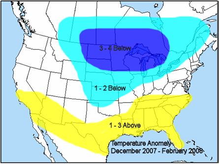
2008 Temperature Anomaly Dec 2007 to Feb 2008
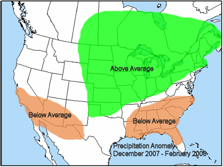
Precipitation Anomaly Dec 2007 to Feb 2008
Winter 2007 / 08 Mean Temperature and Precipitation Verification
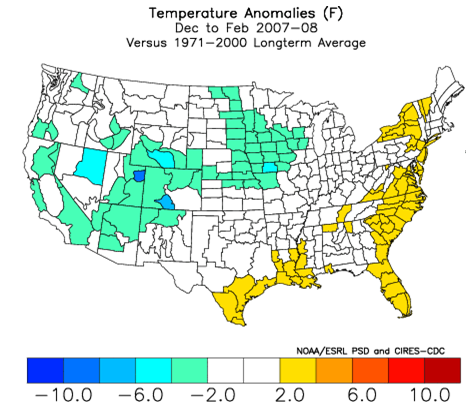

At the end of winter of 2007/08 the largely unexpected low natural gas storage condition made the upcoming summer forecast all the more critical. The fundamental basis of Dave’s forecast issued May 2008 was that summer 2008 would average much more moderate than the excessive heat of the preceding summer 2007 in the major energy consuming areas of the Midwest and East.
Summer 2008 Temperature and Precipitation Forecasts Issued May 2008
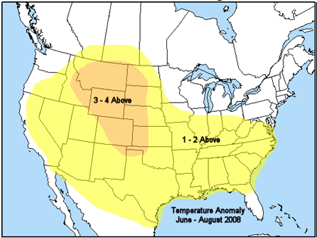
Temperature Anomaly June to August 2008
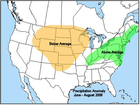
Precipitation Anomaly June to August 2008
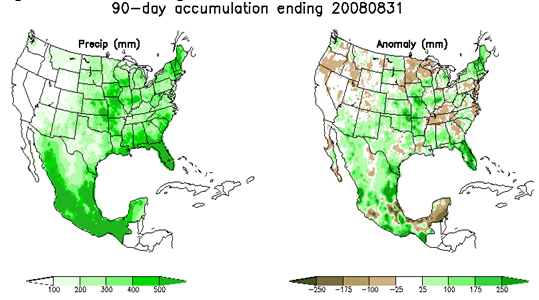
Summer 2008 Mean Temperature and Precipitation Verification

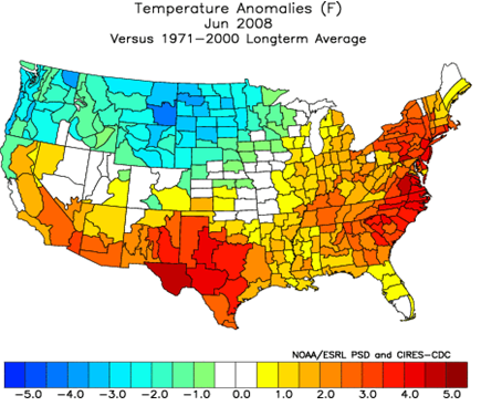
Among the listed primary forecast components issued in May was the following: “June is forecast to represent the greatest positive departures from average temperatures in the northern mid Atlantic and Northeast of the upcoming summer.”
Dave’s June Forecast

Observed June 2008
May 5 - Long Range Summary
Early stages of a blocky slow to change pattern across the U.S. developing late last present weekend prompted substantial model shifts in May forecasts. Forecast changes begin late this workweek (May 8-9) in both the Northeast (cooler) and West (hotter) after a pair wet and cool closed lows over the Ohio Valley and Southwest exit off the East Coast and weaken over the Southeast respectively. Instead of expanding a summerlike ridge currently sandwiched in between over the northern Plains and Upper Midwest eastward into the Northeast as most models forecast last week, all latest runs retrograde the core of unseasonably strong ridging westward generating several consecutive days of the hottest temperatures of the year (mid 100s) across the Southwest (11°-15° above average) into the middle of the 2nd full week of May. In response to increased pattern amplitude models converged to colder downstream solutions as an unseasonably cold Canadian closed low settles directly into the Northeast cooling temperatures 10°-15° below average into next weekend (May 10-11), while widespread rain-cooled conditions focus across he Southeast . Longer range forecasts valid the 11-15 day period are less aligned but deterministic models which recently performed best limit magnitude and duration of seasonably warm air reaching the Northeast early in the period ahead of yet another multiday cold air outbreak going into the 3rd full week of the month (May 18-19). Repetitive cool Canadian air reinforcement into the Northeast through late spring along with wetter forecasts across the Southeast set the stage for a relatively mild start to June across the majority of the Midwest and East (seasonal – slightly above average). In contrast expansive drought currently stretching from the Southwest to the northern-central Plains is unlikely to fully erode adding confidence to a hot start to summer across most of the western half of the U.S.
If your business or career depends on correctly predicting the weather, you can follow the pack or you can get ahead with MWA’s proprietary models and expert forecasts.
